oC
![]()
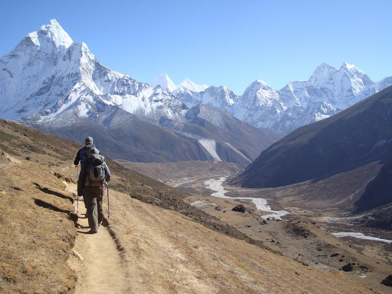
The Everest Region encompasses some of the highest mountains in the world. Of the 14 highest mountains on Earth which are over 8,000 meters, four are in the two national parks located in the Everest region. Such as, Sagarmatha National Park and Makalu-Barun National Park; Mount Everest, Lhotse, Makalu, and Cho Oyu. Mount Everest has long drawn people from all over the world to the Solukhumbu region of Nepal. First climbed in 1953 by Sir Edmund Hilary and Tenzing Norgay. Similarly, the mountain has now become one of the world’s best and most popular trekking destinations. And every year thousands of international visitors come to Nepal to trek in the Everest region. There are many trekking trails in the region. Some that go directly up to Mount Everest Base Camp while others hike over passes to take in the magnificent mountain scenery from a different angle.
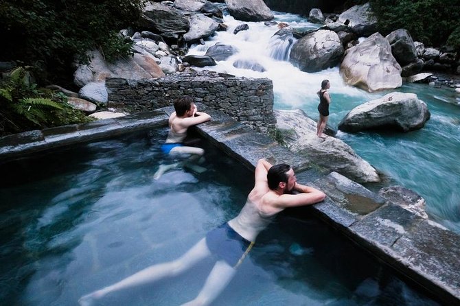
The Everest region’s trekking trails are well maintained, and picturesque Sherpa villages line the trails and offer comfortable lodging – and even apple pie! Colorful prayer flags decorate the landscape, and Buddhist monuments – from the stone stupas to walls of prayer wheels, or manis, welcome trekkers to high villages. Trekking trails in the region go from lush green forests to barren heights and high passes, across valleys and through vibrant Sherpa villages all the way up to the base of the highest mountain on Earth. Stunning scenery, charming Sherpa villages, and the chance to visit the highest mountain in the world should make trekking in the Everest region a must-do on every adventurer’s bucket list.
Next to Mount Everest stands Lhotse, the fourth highest mountain in the world at 8,516 meters. Located in Sagarmatha National Park, Lhotse and another mountain called Nuptse are connected to Mount Everest and form the group of mountains called the Everest massif. The name Lhotse comes from the Tibetan words lho, meaning south, and tse, meaning peak – hence the name “South Peak”. “South Peak” perfectly describes Lhotse and how it is connected to Mount Everest’s southern side by a narrow ridge known as the South Col that rises to about 7,906 meters.
The final camp climbers use to summit Mount Everest, Camp IV, is located on the South Col between the two mountains. Lhotse’s summit is only about 610 meters higher than Camp IV. If it were only 500 meters higher than Camp IV (110 meters lower than its actual height), Lhotse would be considered part of Mount Everest instead of its own mountain.
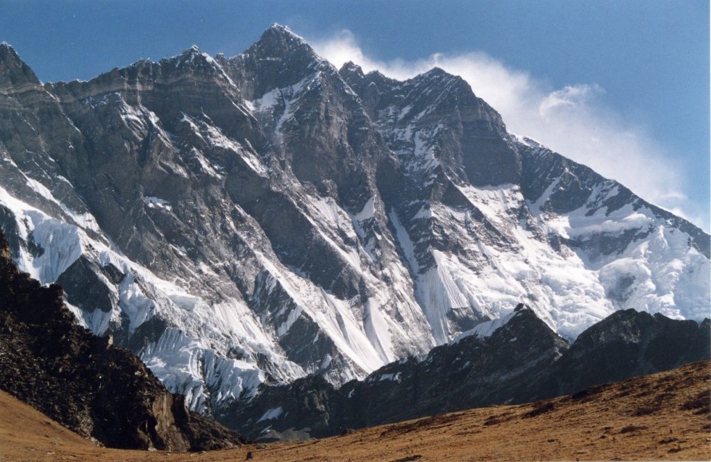
Topographic prominence is the vertical distance between the highest point on a peak and the lowest contour line (lines indicating altitude on a map) that encircles it but does not contain a higher peak within it. Lhotse’s topographic prominence difference is therefore the difference in height between Lhotse’s summit and the South Col where Camp IV sits. With only 110 extra meters of elevation over the 500-meter minimum, Lhotse has the smallest topographic prominence of all the 8,000-meter mountains in the world. In 1955, an international expedition led by Swiss-American Mountaineer Norman Dyhrenfurth made the first attempt to summit Lhotse, which proved unsuccessful.
A year later in 1956, Lhotse was successfully submitted by the Swiss Mount Everest/Lhotse Expedition team headed by Ernst Reiss and Fritz Luchsinger. Lhotse’s lower peaks were later submitted. In 1970, Sepp Mayerl and Rolf Walter of Austria first ascended Lhotse Shar, the lowest peak and a much more dangerous and difficult climb. Lhotse middle remained unclimbed until 2001, when a Russian team, headed by Eugeny Vinogradsky, Sergei Timofeev, Alexei Bolotov and Petr Kuznetsov successfully climbed the summit.
Ama means mother and Dablam means jewel. Moreover, Ama Dablam is beautifully adorned by two ridges of snow joined by a hanging glacier that looks like the jewel. Just as the traditional necklace worn by Sherpa Women with a pendant hanging from it. Not only is the mountain itself magnificent, from the summit of Ama Dablam, there are stunning views of Everest as well as Nuptse, Baruntse and Pumari, Lhotse Shar, Makalu and Cho Oyu. The exciting trekking to base camp winds through the Sherpa homeland above Tengboche monastery. The trail to Ama Dablam base camp branches off of the well-worn path to Everest Base Camp and follows the original line of ascent on the South West Ridge. The rocky trail becomes increasingly snowy nearing the approach to the summit of Ama Dablam.
The summit offers spectacular, spell bounding views of mountains such as Mount Everest, Lhotse, Island peak, Makalu, Khumbu among many others although the South-west route up this sacred piece of ice-covered rock is most common. Ama Dablam Expedition is technically a demanding climb, however, it is truly worth it. The journey of Ama Dablam Expedition commences from а beautiful flight from Kathmandu to Lukla. After this mesmerizing flight, the trek continues to Phakding and then through а steep hill to Namche Bazar.
It passes through the charming villages since it offers the mind-blowing scenery: Pheriche, a place for proper acclimatization. At an altitude of 4570 m, the Ama Dablam Base camp is located in а grassy plain. Retracing the same path, through slate houses, warm, welcoming inhabitants, and raw untrodden areas brings an end to this incredible expedition over one of the most difficult among the below 7000 meters peaks in the world.
The exciting trekking to base camp winds through the Sherpa homeland above Tengboche monastery. The trail to Ama Dablam base camp branches off of the well-worn path to Everest Base Camp. Moreover, it follows the original line of ascent on the South West Ridge. The rocky trail becomes increasingly snowy nearing the approach to the summit of Ama Dablam. The best time for this expedition is in the late autumn season when the weather is cold but fairly predictable. Spring season is also possible. The route is less slippery underfoot during colder weather.
The fifth highest mountain in the world, Mount Makalu is a part of the Mahalangur Himalayas. Moreover, it lies in southeast of Mount Everest on the border between Nepal and China. An isolated peak, Makalu’s shape is a four-sided pyramid. Kang Chun Tse and Chomo Lonzo, the two notable subsidiary peaks of Mount Makalu also add an ethereal feel to the peak. Makalu was first submitted on May 15, 1955 by Lionel Terray and Jean Couzy of a French expedition. Makalu is one of the harder eight-thousanders. Moreover, it is considered one of the most difficult mountains in the world to climb. The mountain is notorious for its steep pitches and knife-edged ridges that are completely open to the elements. The final ascent of the summit pyramid also involves technical rock/ice climbing. Notable feature of visiting Mount Makalu is the beautiful Makalu-Barun Valley.
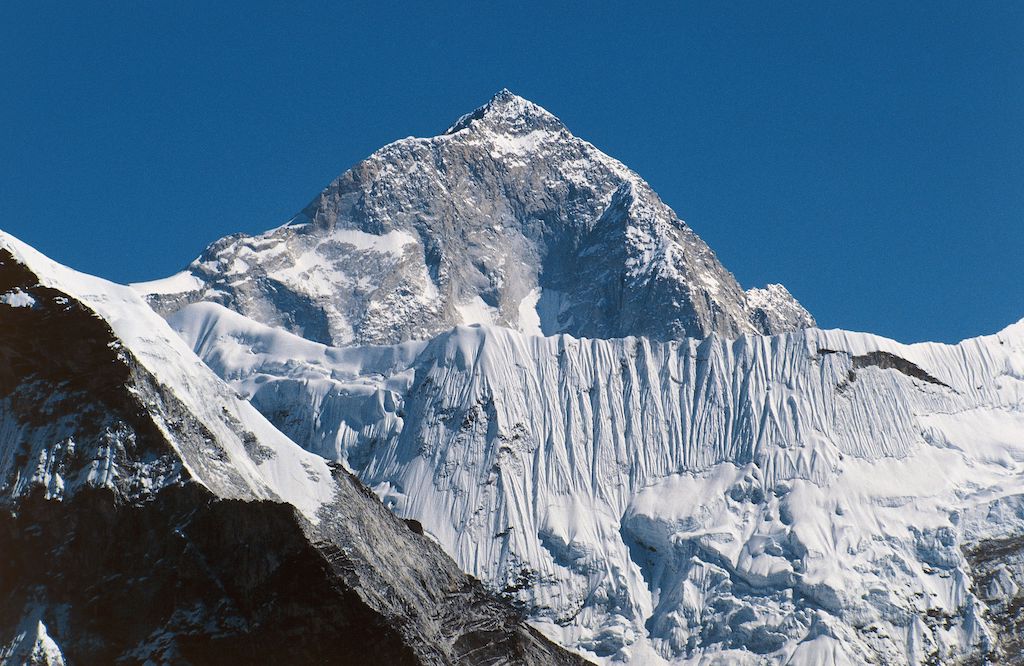
A Himalayan glacier valley situated at the base of Makalu in the Sankhuwasabha district of Nepal. Moreover, the Makalu Barun Valley lies entirely inside the Makalu Barun National Park. Brimming with stunning contrasts, where high waterfalls cascade. Moreover, into deep gorges, craggy rocks rise from lush green forests. And colorful flowers bloom beneath white snow peaks. The valley has a unique landscape that shelters some of the last pristine mountain ecosystems on Earth. Relatively undisturbed by human kind, rare species of animals and plants flourish in diverse climates and habitats.
Standing at 8,201 meters, Mount Cho Oyu is the sixth highest mountain in the world. Cho Oyu is located in Sagarmatha National Park about 20 kilometers west of Everest. Moreover, making it the westernmost major peak of the Khumbu region. Cho Oyu’s name is thought to be derived from the Tibetan words. Chomo meaning goddess and yu, meaning turquoise , hence “turquoise goddess.” Some also believe Cho Oyu to translate to “Mighty Head” or “God’s Head.” A British expedition that included Sir Edmund Hillary first attempted to climb Cho Oyu. In 1952, but was unsuccessful. Cho Oyu was later submitted in 1954 by a small Austrian expedition led by Herbert Tichy without using supplementary oxygen.
Shopping is my option in contrast to Red Bull. Regardless…
Hundreds of years of preservation and perseverance, nourished and timely…
Among the many 12 years festivals Nepal has, Lha Phewa…