oC
![]()
The Sagarmatha (forehead of the sky) in Nepali is known as Mt. Everest throughout the world. With an altitude of 8848m, it is the highest peak on earth. The South face is recognized to lie in Nepal whereas the North face is in China’s autonomous state Tibet. This world’s highest peak was first officially measured in 1856 during the Great Trigonometric Survey of British India government and then known as Peak XV certified with the height of 8840m. With a simple technology and the distance from the mountain, the height was determined with really phenomenal accuracy – only 8m off from the current value of 8848m. The exploration of Mount Everest has a long and varied history – from the first recognition of the peak, to the attempts of Mallory, Irvine, Norton & co and eventually the successful attempt of the British and the impressive solo ascent of Reinhold Messner.
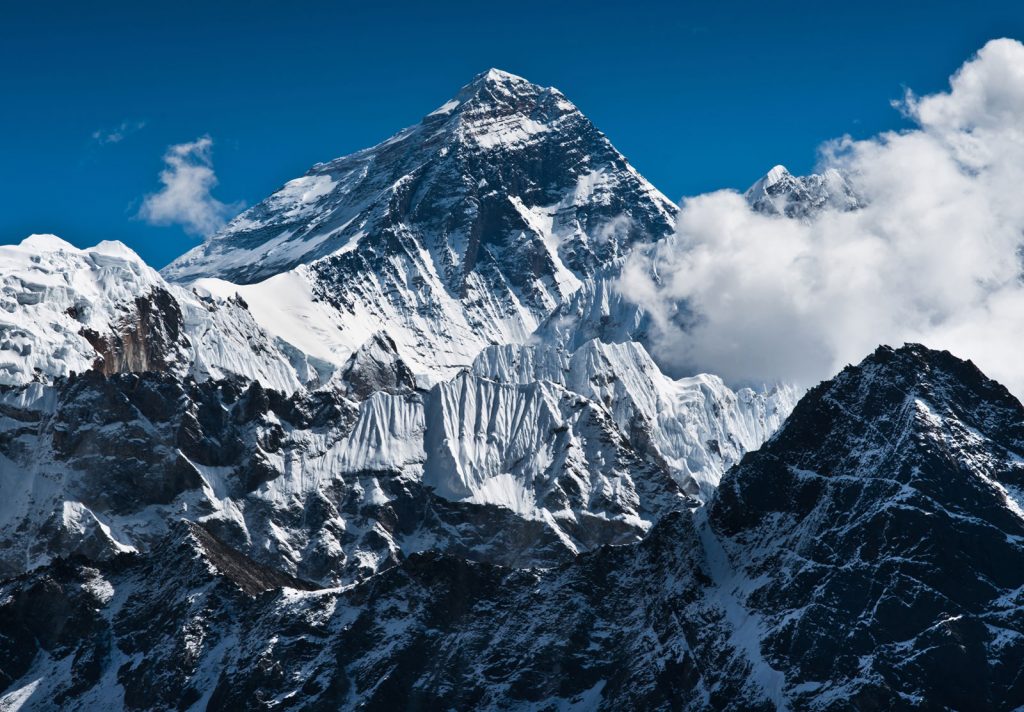
The name of British Surveyor in 1856 was Sir George Everest- the General of British India during the survey period and a somewhat infamous character. Tibet and Nepal were closed to foreigners at the time, so it is reasonable to assume that local names of the mountain were unknown. The name of the highest peak was chosen in his honor, although not without controversy even at the time. The first climbing attempts were not possible until the 1920’s and they ended ultimately in disaster.
Success came only in 1953 from the South side on the very same route you’ll be taking for this expedition. South route is technically a trekking route with a little objective danger once past the Khumbu icefall, a part of few crevasses and Seracs bridged by ladders, a couple short ice cliffs around camp 3 and rock sections protected with fixed lines. There is an obvious danger of high altitude sickness complications and changeable, unpredictable mountain weather.
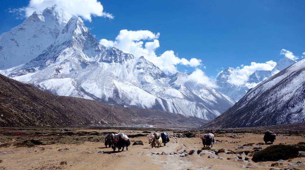
The Khumbu Icefall is a steep glacier with obvious implication of large crevasses and treacherous unstable Seracs making navigation complicated and riddled with high objective danger of falling ice. This is the most dangerous part of the climb. At the beginning of the climbing period, climbing Sherpa set the route through the icefall installing ladders across crevasses and along vertical Seracs ice walls for efficient and easy climbing. These arrangements make climbing of the Khumbu icefall possible, efficient and relatively safe, especially early morning before the sunrise, when the ice structure is well frozen. Khumbu icefall is very dangerous in the afternoon due to its western aspect.
It is located on the top of Khumbu icefall; it is a desolate and exposed place mainly used as a rest and transition location on the way to camp 2 (6400m). The glacier between camp 1 and 2 flattens but there are still large crevasses close to camp 1, which are also fixed with ladders.
It is located in a lateral moraine at the bottom of west ridge. It is a very safe and sheltered location with tremendous views on Lhotse. All companies set-up their main climbing camp for the duration of the climbing period with tents for individual climbers, the kitchen and dining tents. Camp 2 is the main acclimatization camp and the base for camp 3-acclimatization climb and the final summit attempt.
It is located on a small ledge on the Lhotse wall. One has to cross the glacier to the right side before 40 deg. 600m climb on the compact snowfield. The route is safe with a couple of short less than 3m ice cliffs, which climb Sherpa’s set up with fixed ropes.
It is located at South Col is the last camp; it is easily accessible by majority of climbers without supplementary oxygen. There are two rock sections to navigate before camp 4: Yellow Bands interlayer marble, Phyllis and semi schist rocks and Geneva Spur, an anvil shaped rib of black rocks; they are again set-up with fixed ropes.
This is when the climb starts, the last section of the southwest ridge. It is steep mostly on the snow with some rock sections at the Balconies, a nice resting platform. The entire route is set up with fixed ropes, which is crucial for safety of all climbers, who are all affected by altitude with low energy and impaired judgments due to oxygen deprivation in the brain and muscle tissue. From the south summit there is a knife edge southeast ridge with dangerous overhanging cornices; the most exposed section of the climb between 3050m Kangshung face and southwest face and Hillary step at the end, a series of imposing rock steps often bypassed deep in the snow, a serious avalanche danger.
The trekking will start with the flight from Kathmandu to Lukla airport. Lukla airport offers you with lifetime experience as it is one of the dangerous airports in the world. The runway of the airport lies between the two hills which is the difficult runaway for the experienced pilot also. Its airfield is at high elevation and the difference between the two ends of the runway is about 60 metres. From here trekkers will begin their trek to the Phakding with green landscape and view of Kusum Kangaru. The trekkers will stay at the guesthouse here and enjoy the evening and night time with the local cuisine and dinner.
From Phakding trekkers have to cross the river to reach the valley. The trail is near to the river valley with beautiful blue pine and rhododendron forest. After crossing the Dudh Koshi at Benkar , trekkers can get the sight of snow capped peaks of Kusum Kangaru and Thamserku. It is only the short walk to Monjo where trekkers gather around to have lunch. From Monjo , National Park is about a short distance. In the hours of daylight the walking is a little problematic and is an uphill way to Namche bazaar. The trail now goes to the generally flat terrain, crossing back to the right bank to the meeting point of the Bhote Koshi and Dudh Koshi Rivers. The trekkers have to walk through the large suspension bridge.
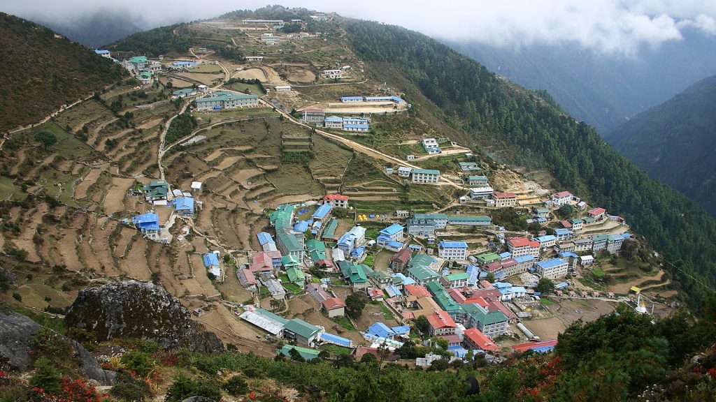
This is the day for acclimatization to the trekkers. The trekkers will hike to Syangboche Airport 3700 metres, the highest airport in the world. Then continue to climb to the Everest View Hotel for great panoramic views of Everest, Lhotse, Amadablam and Tawache. On the way back you can visit Sherpa culture museum and Everest Photo Gallery.
From here, trekkers have to walk towards the park headquarters and climb up above the Dudh Koshi River. The path to Dingboche blesses with the monastery situated below the summit of Mt Everest and bordered by other snow capped peaks. The trekkers can also get the picture of local flora and fauna with the amazing Danphe( national bird of Nepal). After coming at the reforestation area of Trashinga, the track moves down until it comes across the Dudh Koshi River at Phunki Tenga 3250m. After this, it is initially steep through pine, fir, black juniper and rhododendron forests towards Tengboche.
Trekkers have to go high above the Imja River and get further on to the tea houses at Orsho before crossing the river and old glacial moraines on the track to the community of Dingboche. The Mt Everest here is hidden behind the Lhotse-Nuptse ridge.
The trekkers will start hiking after breakfast in the hotel. You have to ascend Nagerjun Hill located on the flanks of the Chhukung valley directly above Dingboche. The foot path becomes steep at times resulting in a physically challenging day. From this altitude there are stunning views of Lobuche East, Lobuche West, Taboche Peak, Thamserku, Kangtega and Amadablam. On a clear day you can even see the Makalu and great views of the Pheriche Valley. After a short break, go back to Dingboche and take a nice rest for a night before starting another day.
You can trek along a broad valley floor to Dughla, passing the Trekkers Aid post at Pheriche.The trekking starts with the large flat land on wide open fields. Then, crossing the Khumbu Khola at Dughla, the trekkers eat a light lunch at the foot of the huge terminal moraines of Khumbu glacier. The fantastic view of Pumori and across the border in Tibet, Changste are seen at the top of the valley.
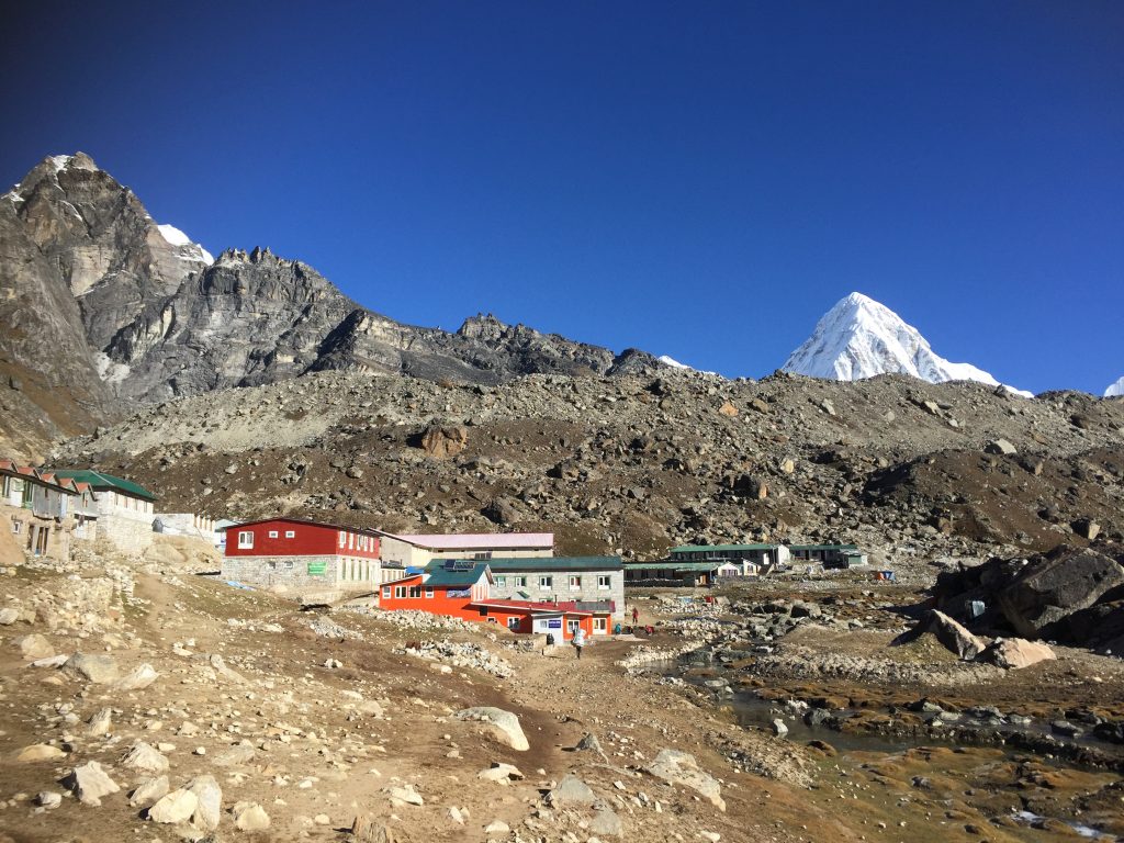
The trekking starts from the wide valley of Khumbu Glacier. It is the firm, slow and steady way towards the moraines of Changri Nup Glacier. The trails make a sequence of small up and down over an unsteady track lined with cairns that shows the way eventually to the blue glacial sands of Gorakshep 5160m. Then, the trekkers head off towards the Everest Base Camp, it is the point for the Mountaineers to summit the peak. They again trek back to Gorakshep in the afternoon and stay there.
This is the best point of the whole adventure as you will be submitting the peak of Mount Everest. You will be guided by the experts Sherpa and Guides. Throughout the whole journey you will be accompanied by the magnificent views of the white Himalayas. You will feel like you are in some kind of Ice Kingdom.
You will retrace your way back to the Base Camp.
The trekkers trek back to Tengboche from Pheriche. The path is pleasant with the views of mountains and forests and reaches to the Tengboche village. The trekkers stay here overnight to explore the village and surrounding. The next morning , they begin their journey to Namche Bazaar. They pass through Tengboche and continue towards the canvas of Monjo valley. The trekkers reach Namche Bazaar and stay overnight in a lodge.
This trekking trail follows a sandy path with strenuous walk. The trail is full of views of landscape and some mountain scenarios. The trekkers can explore Lukla bazaar and local shops. You can also celebrate your successful trekking with special brands of drinks.
Fly from Lukla Airport to Kathmandu Airport and enjoy the panoramic views of snowy mountains from the window of the plane.
Shopping is my option in contrast to Red Bull. Regardless…
Hundreds of years of preservation and perseverance, nourished and timely…
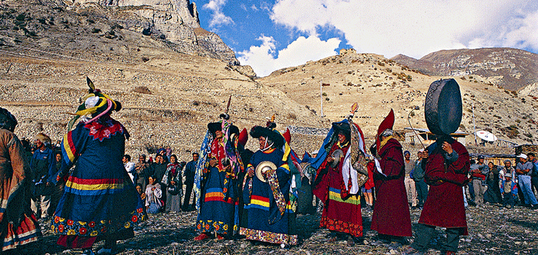
Among the many 12 years festivals Nepal has, Lha Phewa…