Makalu Sherpani Col trek lies in the eastern part of Nepal in the scenic Makalu Barun National Park and conservation area and falls in one of the routes of the Great Himalaya Trail. Due to the challenging nature of the trek that includes 3 passes such as Sherpani Col Pass (6135m), West Col (6143m) and Amphulaptsa (5850m) the trek is recommended for those with a lot of trekking experience. The trek goes through diverse landscapes and interesting cultures of Rai, Gurung, Magar, Chettris, Tamang and Sherpas passing through beautiful forest, floras and fauna. Since most of the places in this region have limited tea houses which is why camping is highly recommended in the region.
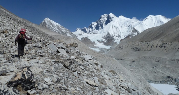

Makalu Base Camp Sherpani Col Trek is without a doubt the longest trek in Makalu region though it touches both Makalu and Everest regions. It is undoubtedly one of the most strenuous treks which require extensive preparation and physical fitness on the part of trekkers. Glacier walking, use of ice axes, and other gears will be necessary to complete this trek. The main goal of the Makalu Base Camp Sherpani Col Trek is to reach Makalu Base Camp. The base camp offers spectacular views of Mt. Makalu (8485m), the fifth highest mountain in the world. Ahead the trek presents almost overwhelming challenges of crossing the Sherpani Col (6150m), West Col (6143m) and Amphu Labtsa Pass (5800m), the three highest passes in the Himalayas.
During this part of the trek you will be greeted by the majestic views of Everest, Ama Dablam and Lhotse and Phortse.
You will take a flight from Kathmandu to Tumlingtar and then take a jeep to Num passing through Haruru.
You will continue along the trail descending steeply from Num through the corn fields of Lumbang. Below the village the trails drop very steeply through a jungle to a suspension bridge over the Arun river. From the bridge we climb steeply to a primitive tea shop, then through corn and buckwheat fields. Moving along the rocky path and tiny terraces planted with corn and barley, we make a long, steep, rough climb to Sedua.
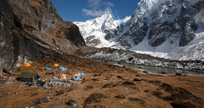

Leaving Sedua, you will make a gradual climb high above the Kasuwa Khola to Gyang (1770m). Climbing past the school at Gyang, it is a gentle walk through terraced fields and forested areas to Hindringham village, and on to Rupisa. En route, you will cross meadows and several streams, and then climb to the Sherpa village of Tashi Gaon.
You will climb over the ridge and ascend through forests to a stream and onto a ridge where there is a small campsite. The trail levels out, and then climbs to a shepherd’s hut called Chipla atop another ridge. You will have to climb past two small streams, then switch back up the ridge in forests to a Kharka at 2900 meters and up to a saddle and Shisha, a tiny meadow at approx. 330 meters. Here the trail joins the ridge that separates the Iswa and Kasuwa drains. The slope gets steeper and becomes a series of moss-covered stone stairs to Dhara Kharka, a meadow atop the ridge. Then you have to move over a hillock and descend a bit to reach Kauma.
Today leaving Kauma, you will climb on steep switchbacks for a while. Then you have to climb less steeply through rhododendron forests to the top of the ridge, with a large mani wall adorned with prayer flags. From here, you get superb views of Chamlang, Peak 6 and Peak 7. Following the ridge for a while, you will have to ascend a stone staircase. After a few false summits the trail veers left off the crest to a small lake.
Then you have to climb gently up a shallow rocky gully to the Kike La (4127 m). From the pass, you have to descend to another lake, then ascend steeply through large boulders to Tutu La. You will continue descending about 150 meters into sparse rhododendron forests to a level area. The final descent is through a forest of firs and rhododendrons to Mumbuk (3570 m). Mumbuk is a forest camp, on a grassy slope about 100 meters above a small stream, with views of snow peaks through the trees.
You will descend a steep gully with a stream for about 500 meters. Then you move left through fir forests, along the flank of the Barun Valley. Moving along an ill-defined trail, you will cross a 200-meter-long slide area, and then follow the river to a Kharka. Moving through forests of birch and scrub rhododendron, you will reach Yangle Kharka. You will Climb from Yangle Kharka, finally crossing to the north side of the Barun Khola to reach Nhe Kharka. There is a small Gompa at the south side of the valley that offers great mountain views.
Beyond the Nhe Kharka, you will follow the north bank of the Barun Khola for a while. Then you will cross a small wooden bridge before the river turns northward. The Barun Valley makes a huge S-shaped curve and the walls rise almost vertically 1500 to 2000 meters above the river, but the trail climbs gently as you approach Ripok Kharka. Still on the north side of the Barun, the trail turns westward and leaves the rhododendron forests for alpine tundra.
Above Ripok Kharka, the route crosses a rocky crest with a few goths, and then ascends alongside a moraine formed by the Barun Glacier. There are excellent views of Pyramid Peak, Peak 4, Chamlang, Peak 3 and Peak 5, but Makalu is not yet visible. As you pass a ridge the glacier turns slightly north. You will enter an alluvial valley and Makalu pops into view just before Sherson (4615 m). Sherson is somewhat sheltered, but still is a very cold spot.
From Sherson, you will have to stay to the right in the gully on the east side of the valley. It is a gradual descent to a minor pass about 100 meters above Makalu Base Camp. Then you will have to descend to a stream, cross on boulders to the base camp on the west bank of the river. From here you will get terrific views of the south face of Makalu. The large buttress of the south face rises across from base camp. An ascent of this buttress yields views of Peak 6, 7 and Baruntse, Everest and Lhotse complete the panorama.
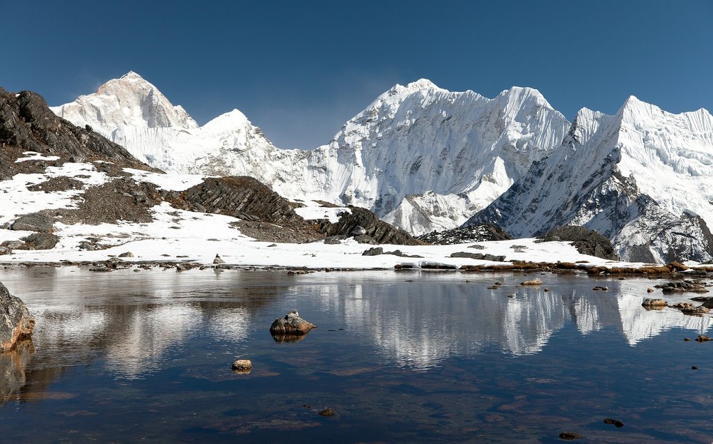

A long walk on the Barun Glacier while gaining altitude today.
We enter a zone of high passes to enter the upper Hunku, a mountain wilderness, a place of massive moraines, glacial lakes and spectacular peaks.
Today we go through our second high pass between the Baruntse and the Pyramid Peak, going on the lower Barun glacier.
The trail goes on the Hunku Glacier to reach Panch Pokhari (5414m) and climbs to the Amphu Laptsha Pass, flanked by the immense fluted ice walls.
The trail goes on the Imja Glacier, at the foot of the Island Peak.
The trail goes down to the last summer settlement of Chukung. The views are tremendous, with the great southern face of Lhotse towering above the north.
Way down on the glacial morain then on a good trail leading to Pangboche small monastery passing Mingbo village. A tremendous view of Ama Dablam south-west face. Sometimes we may see some alpinists on the ridge with binoculars. With a piece of luck too, we may see the Yeti remains, amidst the deities and statues of a dark temple… After crossing the river on a bridge, we walk 2h through a very nice forest well kept by the Tengboche monastery monks. That place name means “the heel print mountain”.
The trekkers trek back to Tengboche from Pheriche. The path is pleasant with the views of mountains and forests and reaches to the Tengboche village. The trekkers stay here overnight to explore the village and surrounding. The next morning , they begin their journey to Namche Bazaar. They pass through Tengboche and continue towards the canvas of Monjo valley. The trekkers reach Namche Bazaar and stay overnight in a lodge.
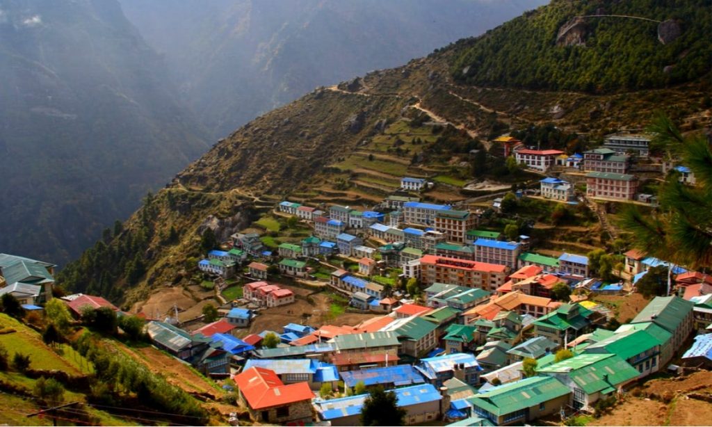

This trekking trail follows a sandy path with strenuous walk. The trail is full of views of landscape and some mountain scenarios. The trekkers can explore Lukla bazaar and local shops. You can also celebrate your successful trekking with special brands of drinks.
Fly from Lukla Airport to Kathmandu Airport and enjoy the panoramic views of snowy mountains from the window of the plane.
Shopping is my option in contrast to Red Bull. Regardless…
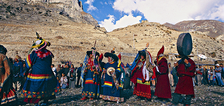

Hundreds of years of preservation and perseverance, nourished and timely…
Among the many 12 years festivals Nepal has, Lha Phewa…