Dhaulagiri Expedition (8,167 meters) is also known as White Mountain is the seventh highest mountain in the world. Among the most popular 8000 meters peak for Himalayan expedition. It forms the eastern anchor of the Dhaulagiri Himal. A subrange of the Himalaya in the Dhaulagiri Zone of north central Nepal. It lies northwest of Pokhara, an important regional town and tourist center. Across the deep gorge of the Kali Gandaki to the east lies the Annapurna Himal, home to Annapurna I, one of the other eight-thou sanders.
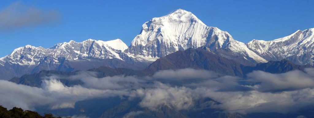

The massif of Dhaulagiri extends from the Kali Gandaki River to Bheri. Bounded on the north and southwest by tributaries of the Bheri River, Mount Dhaulagiri massif is a famous mountain range in the Annapurna region. Dhaulagiri I is the seventh highest mountain in the world. The name of the mountain comes from two combinations of Sanskrit words. “Dhwala” meaning “dazzling, white, and beautiful” and “Giri” meaning “mountain”. Dhaulagiri I is also the highest point of the Gandaki river basin. Annapurna I lies 35 km east of Dhaulagiri I. It has been creating the world’s deepest gorge- the Kali Gandaki Gorge, between these two mountains. The Kali Gandaki River flows through the gorge. The sudden rise of Dhaulagiri I from the lower ridges of the terrain is spectacular. With few trekkers visiting the area, Dhaulagiri Circuit Trek is an off-the-beaten-paths trekking journey of the region.
The Dhaulagiri massif includes the mountains of Dhaulagiri III, IV and V, the main Churen Himal, east Churen Himal, west Churen Himal, Dhaulagiri VI and VII, Gurja Himal, the False Junction Peak, Peak Hawley and the Hiunchuli Patan. On clear weather, the peak of Dhaulagiri I is also conspicuous from northern Bihar in India. Its rise from the Kali Gandaki River is quite notably impressive, along with the south face of the Gurja Himal in the same massif. Its location is also responsible for creating rain-shadow zones in the areas adjacent to the mountain like Mustang and Dolpo. The blockade of rain clouds by the Dhaulagiri massif creates dry and arid environments in Mustang that results on corroded hills and a badland-like environment. Mount Dhaulagiri is also a very popular Mountain range in the Annapurna, and its sight from the Lake-side city of Pokhara is also a grand affair.
When Dhaulagiri was first discovered in 1808, it was thought to be the highest mountain in the world for the westerners. It remained as the highest peak for 30 years before Kanchanjunga took its place. Dhaulagiri justifies a magnificent peak rising as a giant shoulder of shining ice and snow. The South and West faces of Dhaulagiri both feature massive drops; each rises over 4000 meters from its base, and each has been the site of historical climbs.
The peak was first conquered in 1960 by a via North East Ridge. It has been the normal route of ascent for most of the climbing to date. Kurt Diemberger, Peter Diener, Ernst Forrer, Albin Schelbert, Nyima Dorji and Nawang Dorji, members of a Swiss/Austrian expedition, firstly conquered Dhaulagiri expedition on May 13, 1960 via North East Ridge, which has been the normal route of expedition for most of the climbing to date.
The journey starts from the Kathmandu valley from where the bus ride of about 5 to 6 hours will take you to the beautiful city of Pokhara. Through this ride travellers can enjoy the scenic views of beautiful river valleys, alongside terraced fields of barley and rice and over green hills blanketed with lush vegetation. When you arrive at the Pokhara valley there you will witness the beautiful lakes, hills and mountain ranges. The travellers will enjoy the evening here and stay here for a night.
From Pokhara, you will take another drive which takes about three hours to arrive at Beni – the starting point of our trek. From Beni, you will start your trek following the trail that passes through cultural and traditional villages before reaching Tatopani.
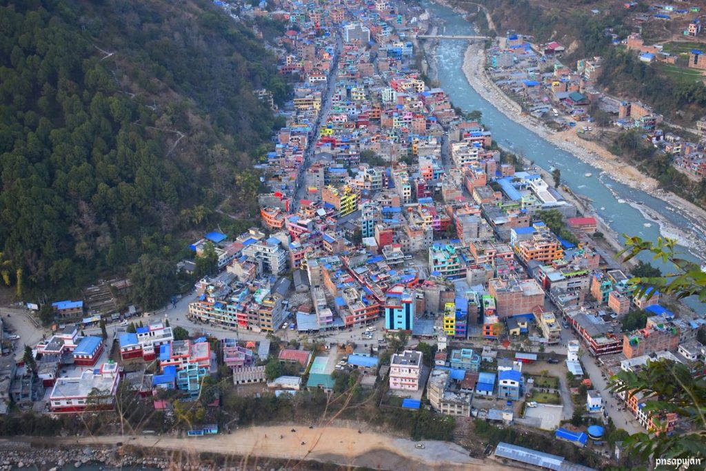

Tatopani literally means ‘ Hot Water ‘, there is a natural Hot Spring at Tatopani where you can relax and have a great time. It is believed that the natural hot springs have the potential to heal body aches and pains. From Beni you will walk through the cultural and traditional villages.
The trail leads you Dharapani along the bank of Myagdi Khola. There might be a disturbance in the path in several places during the monsoon season due to landslides that lead to several ups and downs. The trail passes by several settlements along the trail to Dharapani.
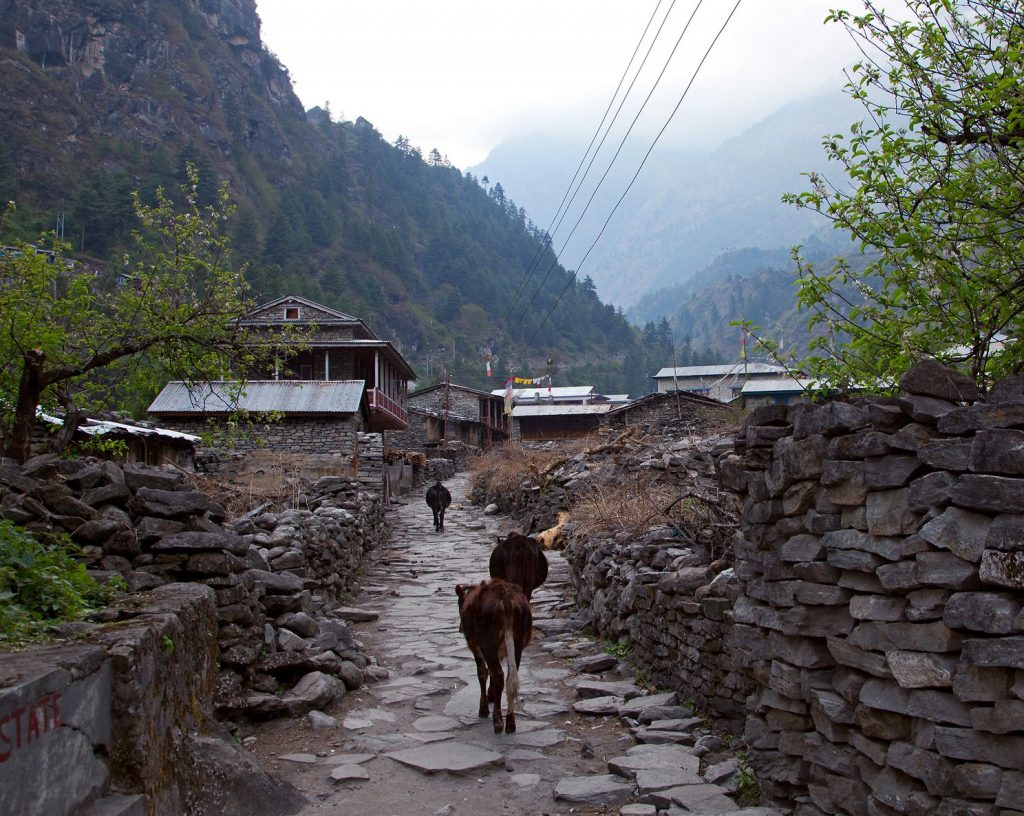

You will leave Dharapani and then follow a rather easy trail that passes through beautiful terraced fields of rice and wheat. During the trek today, you will enter and exit through many traditional villages with a magnificent view of high mountains along the way. The travelers will continue their trek by crossing a suspension bridge above Dhara river and make an ascend from there to reach a Magar ethnic tribe community-based village of Muri.
From Muri the trial descends down a rather steep slope down towards a suspension bridge. After crossing the suspension bridge over the Muri Khola you will continue trekking that passes through dense bamboo filled forest and farmhouses. You will head north and after a short period of trekking, the valley widens. You will emerge to the open fields before arriving at Boghara for your overnight camping.
Leaving Boghara you will follow the trail that goes along the west bank of Myagdi Khola through the lush subtropical forest to reach Lipshe. From there, your trek continues passing through traditional villages where you can get a glimpse of villagers trying to collect honey from high above the trees and hills. You will continue to follow the trail through dense forest areas to arrive at Dobang. Dobang comprises several tea houses with good camping sites.
You will leave Dobang and follow the route that heads through dense rhododendron and bamboo filled forest. The trail descends for a while to cross Myagdi Khola over the bridge, and from there continue trekking on the trail that goes along the east bank of the Myagdi Khola. It goes through deep lush forest as you head towards Sallaghari for your overnight camping.
From Sallaghari, you will follow the trail that passes through the dense rhododendron, pine and birch filled forest before climbing up to an open area. The trail from there goes over the lateral moraine. After some time of trekking, you will arrive at the Italian Base Camp. From the Italian Base Camp, you can enjoy a magnificent and up-close west view of Mt. Dhaulagiri at 8,167 meters.
Glacier camp is situated between the Italian Base Camp and Dhaulagiri Base Camp. The trail descends steeply down towards a glacier. From there, it is difficult and so you need to be very aware as you trek over the glacier. After crossing the glacier, the trail goes along the moraine on the left side of Chonbarden Gorge. From there you will follow a narrow trail that heads towards Glacier
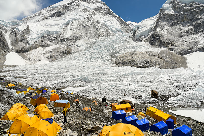

You have reached over 4,000 meters above sea level. So, today you will take a day rest at Glacier Camp for acclimatization and exploring around Glacier Camp. You will have great views of surrounding mountains valleys and snow-capped high peaks from Glacier Camp.
After spending a full day resting at Glacier Camp. You will continue on your trek following a trail that is gradual uphill trekking all the way to Dhaulagiri Base Camp. The trail is often snow-covered and icy, in such conditions. You will use our crampons and head towards Dhaulagiri Base Camp. From where you can enjoy great views of Dhaulagiri Mountain Ranges.
Today is the day you have been desperately waiting for. Fully equipped with all the climbing gears and properly acclimatized. You will start early with the aim to reach the summit, as the strong winds afternoon can create obstacles in reaching the summit. Following the guidance and instructions of experienced climbing experts. You will tackle several technical sections and head towards the summit of Dhaulagiri Peak. Your tiring climb to the summit is rewarded with breathtaking views of Annapurna I, Annapurna II, Annapurna III, Annapurna IV, Annapurna South, Nilgiri South and North, Tilicho peak, Tukuche Peak and other snow-capped peaks. After spending short and quality time at the top. You will have to descend following the same route and head back to base camp.
After successfully achieving the summit of Dhaulagiri Peak, you will return following the trail that climbs up a moderate snow slope towards Dhampus Pass at 5,240 meters. After successfully crossing the pass you will make a steep descent entering into the Kali Gandaki Valley – World’s Deepest Gorge. You will make a rather long traverse across the snow which usually takes around four hours before descending further down to arrive at Yak Kharka.
The last day of trek starts from Yak Kharka and descends for a few hours to reach the village Marpha, also known as the Apple Garden. From Marpha you will follow a rather easy trail all the way to Jomsom. Jomsom is the main administrative centre of Mustang. It is an important hub for Upper Mustang Treks with the airstrip and abundance of tea houses and services.


The travelers will take a flight back to Pokhara. The remaining afternoon can be spent exploring the beautiful landscapes, lakes and hills of the city. You can also roam around the market area of the Pokhara in the night. Also, you can get yourself immersed in the limelight of the city.
It is time to bid farewell to the Pokhara valley and take a bus ride back to the Kathmandu valley. You can enjoy the beautiful landscapes, river valleys and clear sky through the window of the bus before reaching the city.
Shopping is my option in contrast to Red Bull. Regardless…
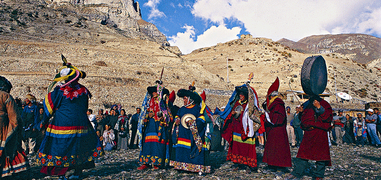

Hundreds of years of preservation and perseverance, nourished and timely…
Among the many 12 years festivals Nepal has, Lha Phewa…