oC
![]()
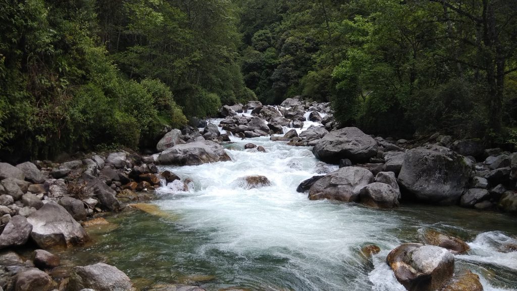
Dolpo is also called “Ba Yul” or the Hidden valley is a land of mystery, scenery and peace. Surrounded by Dhaulagiri and Tibet from south and north. The Dolpo region is the natural embodiment of high passes, rare flora and fauna and sweeping vistas. The medicinal plant, Yarchagumba (Coerdiopsis sinensis) a type of wild mushroom is found in abundance in this region. Extracts from Yarchagumba are believed to significantly improve health and fitness. This trekking is for a combination of natural and cultural phenomena which is enriched by the traditional Tibetan cultural heritage. It is a rain shadow area and was opened in 1991 for trekking. The whole trekking area in this region stretches through and around Arun River whose origin dates back to prehistoric period. The Arun valley is one of the most beautiful regions to trek in Nepal.
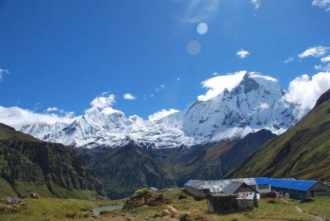
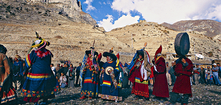
Dolpo is protected by Shey-Phoksundo National Park. It lies to the north of the Dhaulagiri Range bordering the Tibetan Plateau. Here one can find a well-preserved ecosystem of plants and wildlife, including the blue sheep and the elusive snow leopard. The view of Kanjiroba peak, Phoksundo Lake, and the Dhaulagiri massif is one of the most rewarding moments of this trek. A visit to the Phoksumdo Gompa – dedicated to the ancient Bonpo religion, local to Dolpo and Tibet, is a memorable experience.
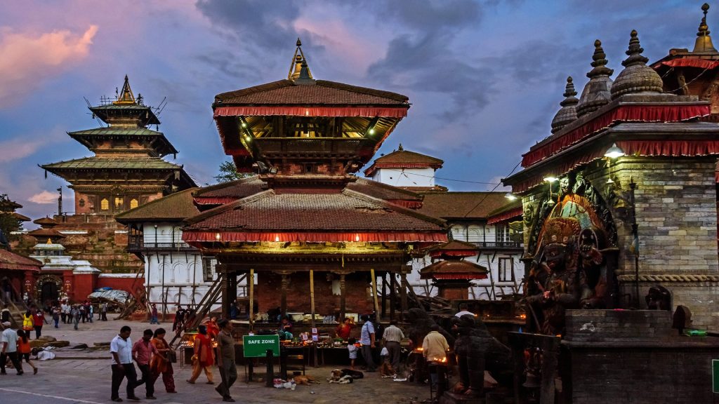
Drive from Kathmandu to Beni which takes about eleven hours. As you climb out of the Kathmandu valley, only to quickly descend again to the Trisuli River, you follow upstream to its junction with the Marsyangdi River. You follow the Marsyangdi gently up through heavily terraced fields and small hill towns to the Seti River that takes you directly into Pokhara. Having pleasant weather, Pokhara is a tourist’s paradise full of natural as well as cultural heritage sites such as lakes, caves, temples of Buddhist and Hindus along with mountains.
You can observe views to the north across the hills and Phewa Tal (lake) to the white peaks of the Annapurna and Dhaulagiri ranges. The drive from here goes uphill into zigzag road all the way to Naudanda. It then descends through zigzag road up to Nayapul with views of Annapurna South, Fish tail, green hills, terraces and villages. To reach Beni, your drive moves along the bank of Mardi River. This is one of the picturesque road journeys.
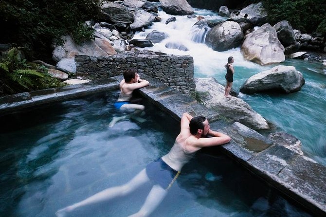
Trek from Beni (770m.) to Tara Khet (970m.)Via Singa Bazaar (850m.) which takes about seven hours. To reach Singa Bazaar you have to follow past the hot spring along the bank of Beni River with views of villages at some distance. Singa Bazaar is a village with tea shops, lodges, hotels, beautiful terraces and typical houses. There is a small market which provides minimal supplies. Leaving Singa Bazaar, you move through quite flat land all the way to Tara Khet passing through villages. On the way, you can see mules carrying loads. Tara Khet is another village and it is famous for Marijuana.
Trek from Tara Khet to Danyga Khola (1125m.) and it takes about six hours. Today you trek through gentle ascent paths until you reach Panchey (1700m.) passing villages, few trees and green hills. Now crossing a suspension bridge over Beni River you arrive at Tokra (1820m.), a village. Descending gently for a couple of minutes, you reach Junla (2020m.), mostly considered as a pass. The trail appears to be quite flat passing through villages, sparse forests and green hills and you reach Danyga Khola. Danyga village lies at the bank of Danyga Khola. There are few typical houses and you can see local people, who mostly belong to the Magar community, are involved in farming.
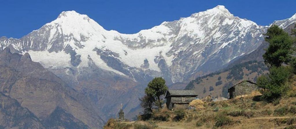
Trek from Danyga Khola to Dharapani (1470m.) which takes about six hours. The trail is ascent and descent as well at the beginning and later moves through flat land all the way to Dharapani. En route you can enjoy the spectacular views of green hills, forests, typical houses and mountain views of Dhaulagiri, Mana Pathi Himal and other unnamed mountains. Dharpani is a village with good infrastructure. There is a tap (dhara) at Dharapani and the village is named after this. Local people of this area belong to Magar, Chhetri and few other communities.
Trek from Dharapani to Muna via Sibang and it takes about six hours. At first you trek through gentle flat land with green hills on both sides. After some distance, the path goes quite up for a long distance passing through villages, forests covered with pine, oak, rhododendron and local vegetation. Before you enter Muna, you have to trek through the flat for a couple of hours. Muna is a big village with good infrastructure. Most people here are devotees of Hindu God and Goddess.
Trek from Muna to Jaljala La via Lumsum and Moreni which takes about seven hours. To reach Lumsum you have to trek through steep ascent paths passing through the oak and rhododendron forests with views of Dhaulagiri, Mana Pathi and few other unnamed mountains. The path is steep up until you reach Jaljala La passing through Moreni, a village where people follow Tibetan lifestyle. Jaljala is alpine grassland atop a ridge where people of surrounding villages bring their domestic animals such as yak, sheep for grazing. This is best described as a hunting area. From the top you are speechless to see at the panoramic views of Dhaulagiri range
Trek from Jaljala La to Dhorpatan via Gurjakot and it takes about seven hours. The trails until Gurjakot are steep descent and then it moves through flat land all the way to Dhorpatan. You walk along the bank of the river passing through forests covered with oak, pine, rhododendron, juniper and other local vegetation. Gurjakot is a small village mostly dominated by people who follow Tibetan culture.
There are chortens, mani walls and prayer flags fluttering in the bridge. On the other hand, Dhorpatan is a point where roads from Baglung, Beni, Rolpa and Rukum meet. There is a small airport. You can see apple orchards and wheat, buck wheat, maize and mostly potatoes growing in terraces. One of the most significant features about this place is that anyone can go for hunting by paying certain fees to the Government authority. As Dhorpatan is the only area for hunting in Nepal
Rest day at Dhorpatan. Excursion in and around places. You can visit monasteries, chortens and local markets. Hiking green hills will give you another pleasure. The typical houses with wooden roofs attract you. You can learn about the social and cultural life style of local inhabitants
Dhorpatan to Takur via Phagune Dhuri Pass which takes about six to seven hours. Leaving Dhorpatan you head uphill up to Phagune Dhuri Pass passing grass land and sparse forests. This pass is surrounded by green hills and you can see villages at some distance from the top. Now the trail goes steep down passing villages, terraces and a suspension bridge over Pelma Khola (stream). As you cross bridges you begin to follow gentle ascent paths through terraces and local villages all the way to Takur. This is a small village where you find local people being involved in their daily activities.
Trek from Takur to Pelma and it takes about six hours. The supposed trail moves down all the way to Pelma crossing a wooden bridge over Pelma Khola. On the way, you can see several villages, terraces, green hills and local people. Pelma is a village and people living in and around this area are not well to do. As you can see not well managed houses and people being involved in farming
Trek from Pelma to Dhule via Yamakhar and Gorba Khola which takes about seven hours. Crossing Pelma Khola the trails go step up all the way to Dhule. En route, you pass through picturesque villages, terraces and green hills. Dhule is yet another village at a certain height.
Trek from Dhule to Seng Khola (3820m.) via Nautale Bhanjyang (3961m.) and it takes about six hours. The beginning part of the trail moves through the pine, rhododendron, juniper forests along the steep ascent path until you reach Nautale Bhanjyang. You can enjoy the panoramic views of Dhaulagiri range and other unnamed mountains. Nautale Bhanjyang, atop a ridge is a grassland where local people bring yak and sheep for grazing. To reach Seng Khola you trek through gently ascent for a couple of hours and the trail turns step up all the way to your destination. Seng Khola is a village which lies at the bank of Seng river. You can see terraces with wheat, buck wheat and mainly potatoes growing in it.
Trek from Songkhla to Purpang (4050m.) via Paanidal Pass (4412m.) which takes about seven hours. You trek steep ascend all the way to Purpang following rocky and dry land. En route you come across alpine grassland. From Panidal Pass you can have panoramic views of Dhaulagiri range, Kantagaton Himal, Nurbukang Himal and other unnamed mountains. While heading towards Purpang, you cross rocky and slippery trails. Purpang is an open rocky grass land surrounded by spectacular mountains
Trek from Purpang to Sahar Tara (3010m.) via Jangla Bhanjyang (4530m.) and Tokar (3740m.) and it takes about seven hours. The trail you follow is steep ascent up to Jangla Bhanjyang passing through rocky trails. You are accompanied by panoramic views of Norbu Himal, Kantagaton, Dhaulagiri, Serkeam Himal and a few others. After you Jangla Bhanjyang, you are quite surrounded by above mentioned mountain views. Crossing Jangla Bhanjyang, you begin to follow a gentle descent path all the way to Tokar. It is a small village surrounded by hills. To reach Sahar Tara, you again follow a steep descent path passing through a few villages and sparse vegetation. Sahar Tara is yet another village with terraces which lacks necessary infrastructure and far from modernization
Trek from Sahar Tara to Kanigaon (2540m.) via Tarakot (2550m.) and Yalkot Khola (2520m.) which takes about seven hours. Crossing several villages you walk downhill all the way to your destination. Tarakot is a small village which falls en route. Yalkot Khola is also a village which lies at the bank of Barbung Khola. The camping spot Kanigaon is yet another small village where you find a small market with shops, tea houses and lodges.
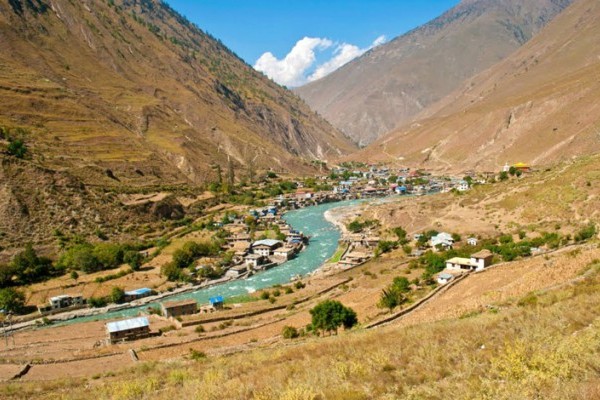
Trek from Kanigaon to Dunai (2150m.) which takes about seven hours. Leaving Kanigaon, you begin to follow a gentle descent path along the bank of Thulibheri river passing through villages and terraces. Dunai, headquarter of Dolpa district lies at the bank of Thulibheri river. There are lodges, tea houses, hotels, government offices, hospitals and other infrastructure.
Trek from Dunai to Juphal (2490m.) and it takes about two and half hours. After walking through a flat level path for some hours you begin to follow a gentle ascent path passing through villages, terraces and sparse vegetation. You find farmers cultivating paddies around this area. There are airports, offices, lodges, tea houses, hotels and typical houses of local people.
Fly from Juphal to Nepalgunj to Kathmandu.
Shopping is my option in contrast to Red Bull. Regardless…
Hundreds of years of preservation and perseverance, nourished and timely…
Among the many 12 years festivals Nepal has, Lha Phewa…